Celebrating Scotland’s Year of History, Heritage, and Archaeology
Presented by Diana Murray
A fascinating insight into the rich cultural and historical heritage of Scotland’s coasts and offshore areas.
Presentation
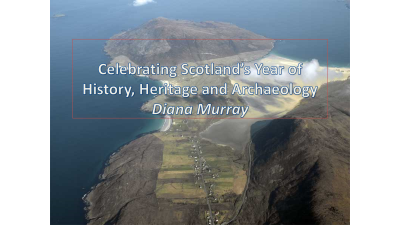
Presented by Diana Murray
A fascinating insight into the rich cultural and historical heritage of Scotland’s coasts and offshore areas.
Presentation
Presented by Tony Birr, State 21
Just how prepared are you when the unexpected happens? Is there a risk assessment in place to minimise possible incidents? Are lessons learnt from near misses so that the situation cannot arise again? Are there post incident reviews so that you are able to learn from any mistakes? Businesses need to be more prepared for when things does go wrong so the situation isn’t made worse. This can be through auditing and inspection or a record of previous preparation. Staff need to be trained so that they are confident to handle the unexpected when it does arise. The unexpected can be organised crime, accidents, or disasters.
Presentation
Presented by Clare Postlethwaite, MEDIN
Is poor data management putting your operations at risk? Do you know what data you have and how to use it? Easier data sharing is required through growing expertise, a marine data catalogue and using MEDIN, the hub for UK marine data. This will help improve access to, and management of UK marine data and information. MEDIN has greatly increased access to Marine Data since its inception so that Marine data is now more widely available across all regions of the UK.
Presentation

Presented by Amanda Forbes, SeaRoc
The key factors to risk migration to help cut the risks offshore includes: Health and safety for offshore safety and competency/certification management, Asset protection to prevent costly damages and operational efficiency for optimising assets and limit downtime. There is also the need to maximise data value through confident, data-driven decision making.
Presentation
Presented by Caroline Levey, OceanWise
Port-Log connects with existing tide gauges and wind sensors which are linked to a Port-Log system hosted on an external cloud server. There are user specific pages for marine users such as VTS, Pilots and Dock controls. Port-Log can be accessible within the Client WAN/LAN and externally to remote users. Recently there have been new applications applied to Port-Log including Water Quality monitoring, River level monitoring and Port-Log relay (mobile weather station).
Presentation
Presented by Rhys Cooper, British Geological Survey – BGS
Data management needs to be applied throughout the entire workflow from the acquisition of the data through to processing it and finally to the delivery to the customer. When it comes to sea-bed sediment maps and how we utilise new and update the old data, there is the need to create new interpretation workflows to backscatter processing and classification of the seabed.
Presentation
Presented by Dr Francis Neat, Marine Scotland Science
Planning in remote landscapes without high resolution up-to-date and accurate mapping data means that sub-optimal decisions could be made. The resulting plans may mean that some ecological or conservation aspects may be missed.
Presentation
Presented by Alina Piotrowska, Scottish Natural Heritage
Understanding and using marine geospatial data in Scottish Natural Heritage (SNH), a mainly terrestrial based organisation but with a marine remit, is challenging when team members are not fully conversant with marine mapping data or indeed even navigational charts! As a result, analysing marine data and understanding how it should underpin decision making and asset management in SNH presents a unique problem. Examples mentioned were utilising WGS 84 coordinate reference system rather than British National Grid to display and analyse the data and improving the understanding of the topology used in OceanWise Marine Themes data. Also, the Marine Recorder, the database application used by SNH to store marine benthic sample data such as species, physical attributes and biotopes is not yet MEDIN compliant and thereby the data is not readily accessible for sharing with other organisations.
A plea was made for additional data management training for SNH to overcome these problems. This will be remedied as soon as possible by OceanWise, working with SNH and Marine Scotland.
Presented by James Thorburn, Marine Scotland Science
James Thorburn, Fish Tracking Officer at Marine Scotland Science discussed the technologies used and analyses required to track skate movements in the Sunart to Sound of Jura Marine Protected Area (MPA) in the West of Scotland. The ongoing tracking process involves tagging fish to assimilate variable oceanographic parameters and by using high resolution bathymetry to locate species in different acoustic and depth conditions over both the short and longer time periods.
Presented by John Pepper, OceanWise
Data and information is one of any organisations most valuable assets and is critical to most business functions. Treating data as a business management function can bring many benefits. This is so that critical data is to hand when and where it is needed to ensure more cost effective operational planning and management. Also, accessing data from multiple sources will assist in establishing a ‘common operating picture’ to underpin projects, programmes and responses to emergencies.
Presentation