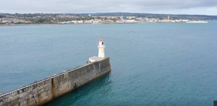
Last night’s BBC Countryfile programme took us to the Cornish town of Newlyn which houses, in an unassuming hut at the end of their pier, the fixed point (a brass bolt) that it used for the UK’s ‘sea level’. Amazingly this fixed point forms the base point for all ‘levelling measurements and the basepoint for UK maps!
The programme also features a historic tide gauge and explains how tidal measurements were taken here and the data they have provided makes up “the most complete sea level measurements in the world”. The Newyln tide gauge is part of the EA’s UK National Tide Gauge Network – a network of 43 tide gauges which are spread around the coasts of Britain. Learn about our role in servicing and and maintaining extremely important assets (read more).
Watch the full episode @ BBC iPlayer – Countryfile – Newlyn


