

We have developed a range of courses specifically for the International Hydrographic Organisation’s (IHO) Worldwide Capacity Building Programme
These courses provide vital training to Regional Hydrographic Commission (RHC) members on the subjects of Data Management, Database Design as well as developing Marine Spatial Data Infrastructures (MSDI). Our below courses can also be run as part of the FIG/IHO/ICA International Advisory Board on Standards of Competence for Hydrographic Surveyors – Category B Courses, in the UK and Europe.
Our “Capacity Building” course provides training on Data Management, Database Design and the Marine Spatial Data Infrastructure. The aim of the programme is to enable greater access to, and sharing and exchange of geospatial data at an organisational, country or regional level, in a way that promotes and delivers ‘best practice’ across multiple stakeholders. These courses are designed for marine professionals and cover data management and the four pillars of MSDI, namely Content (Data), Standards and Specifications, Technology (ICT) and Governance (People and Organisations).
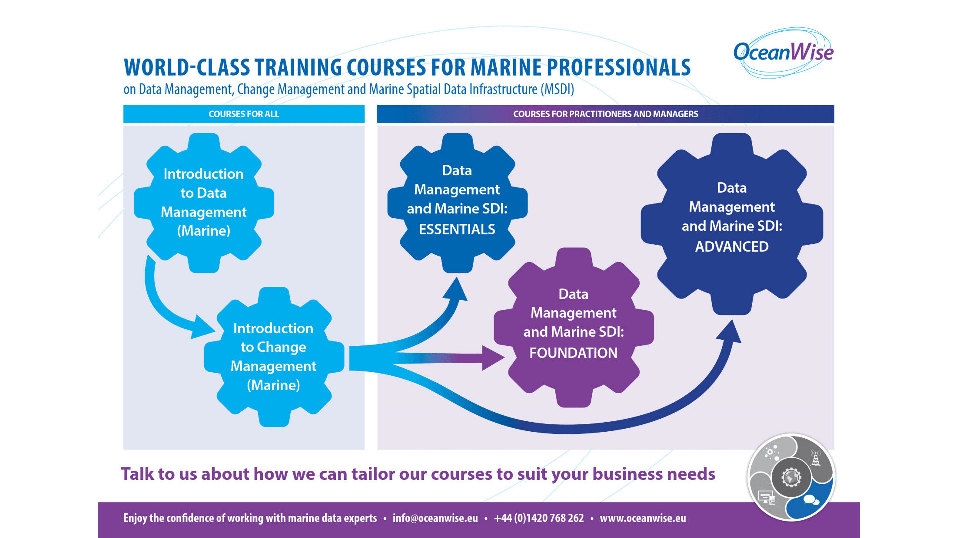
Below is our list of ‘off the shelf’ courses but we can also offer bespoke training courses on this subject on request:
This is a 1-day workshop, which we have successfully delivered to many national Hydrographic Offices and commercial companies across the world. It covers the four pillars of MSDI and how these crucial elements need to interact to ensure MSDI can be successfully delivered. This course is aimed at practitioners and middle managers. See our Training Guide for more details and modules covered in this course.
This is a 2-day course has been created for managers working with, or intending to work, with geospatial, operational or business data, who wish to gain a fundamental understanding of Data Management and Governance and MSDI from a management and / or decision-making perspective. This course includes training on data management, data governance, data quality, data publishing and MSDI. It specifically includes a module on Data Policy and Strategy. See our Training Guide for more details and modules covered in this course.
This can be delivered as either a 3, 4 or 5 day course, covering theoretical and practical modules on data management, database design, data publishing and MSDI. It is aimed at practitioners who are working, or intend to work, with geospatial, operational or business data in government or commercial companies. The training examines data and its constituent elements including governance, life-cycle, quality, management and metadata. We also focus on how organisational culture and individuals respond to the changes necessary to adopt a ‘data centric’ approach to their operations. We have delivered this training across the world on behalf of the International Hydrographic Organisation (IHO) through its capacity building programme and to individual government departments and agencies and has consistently received high scores. The 4 and 5 day options allow for more in depth discussions, practical / breakout sessions. See our Training Guide for more details and modules covered in this course
We run these courses throughout the year and they are usually run on site (at a venue of the client choice) both in the UK and abroad. Contact us for availability. Contact Us for availability.
IHO members at £475 + VAT per tutor, per day (12 people to 1 tutor) + expenses
Contact us on info@oceanwise.eu or +44 (0) 1420 768262
See our Training Guide for more details and modules covered in each course.